Patch: Digital Coastal Mapping Seen As Way To Prepare For Floods, Storms
Maryland Rep. Dutch Ruppersberger has proposed a digital map of the entire U.S. coastline to help plan for floods and storms.
Maryland Rep. Dutch Ruppersberger, D-Cockeysville, has introduced a bipartisan bill that would pay for a project to produce a digital map of all 95,000 miles of the U.S. coastline.
Coastal communities like Baltimore and Ocean City would benefit from the collection of geographic data about the nation's coasts that would help prepare people against floods and storms, sponsors of the legislation said.
The project also would help researchers better understand storm surges, water level trends, and erosion around both oceans, the Gulf of Mexico and the Great Lakes.
"America's fragile shorelines are home to more than half of our country's population and millions of businesses that supply most of our gross domestic product," Ruppersberger said in a statement. "Yet current coastal maps and geospatial data are woefully inaccurate, outdated, or even nonexistent."
"The Digital Coast Act will give local planners and managers the high-tech data they need to make accurate decisions and smart investments that could save people and property," the congressman added.
The bill is the sixth version Ruppersberger has introduced. It picked up more support with each version. The current bill proposes giving $4 million to the National Oceanic and Atmospheric Administration to collect the data and create a digital map.
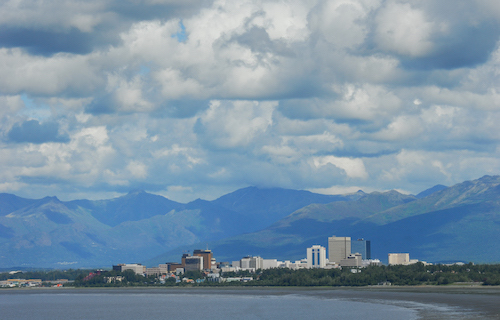
"No other state in the nation understands the need for coastal resilience and mapping more than Alaska," said Rep. Don Young, R-Alaska, who first joined Ruppersberger on the bill in 2012. "With more than 44,000 miles of coastline, much of which is not fully mapped, Alaska's coastal communities rely heavily on our waterways and shipping channels to support all forms of social and economic prosperity: goods from the lower 48, critical transportation needs, search and rescue operations, and the state's largest private sector employer – our fishing industry."
The congressman from Maryland has been altering the bill slightly every year that he has brought it up. The first iteration in 2010, which had no co-sponsors, asked for $100 million to fund the coast-to-coast endeavor. The original bill was sent to two committees but never got to the House floor.
The second version in 2012, which Young co-sponsored, reduced the spending proposal to $85 million instead of the original amount. That bill also didn't make it past committee hearings. The 2016 bill included more background on the concept and a budget request of "such sums as may be necessary to carry out the program.In 2017, a bipartisan group of 18 co-sponsors joined the congressman in the map proposal, with a budget of $4 million.
The latest bill kept the $4 million budget and so far only has Young as a cosponsor, but it is more likely to pass in the Democratic-majority House since most of its supporters last year were Democrats. If a companion bill successfully passes in the Republican Senate, as two did in previous congressional sessions, the proposal would got to President Donald Trump's desk for his signature.
"By comprehensively mapping and surveying our coastline, we can ensure we have readily accessible and up-to-date tools for coastal management, planning, and disaster response," said Sen. Lisa Murkowski, R-Alaska, who co-sponsored the bill that passed the Senate in 2017 and is co-sponsoring the new bill.
"...The Digital Coast Act helps give us a stronger understanding of what's happening along our shorelines and underneath our waters," Murkowski said.
By: Deb Belt
Source: Patch